Weissfluhjoch SwissMetNet AWS (WFJ) Contributing Station Information
An important SwissMetNet meteorological station operated by MeteoSwiss within the site Weissfluhjoch - Davos.
The station was originally registered based on WMO Pub 9 Vol A information containing these observation remarks: AUT;M;RAD;SNOW;SOLRA;SUNDUR (see code table A for explanations). These remarks imply the following additional observations that could not be registered automatically: Radiation measurements; Snow survey; Solar radiation measurements.
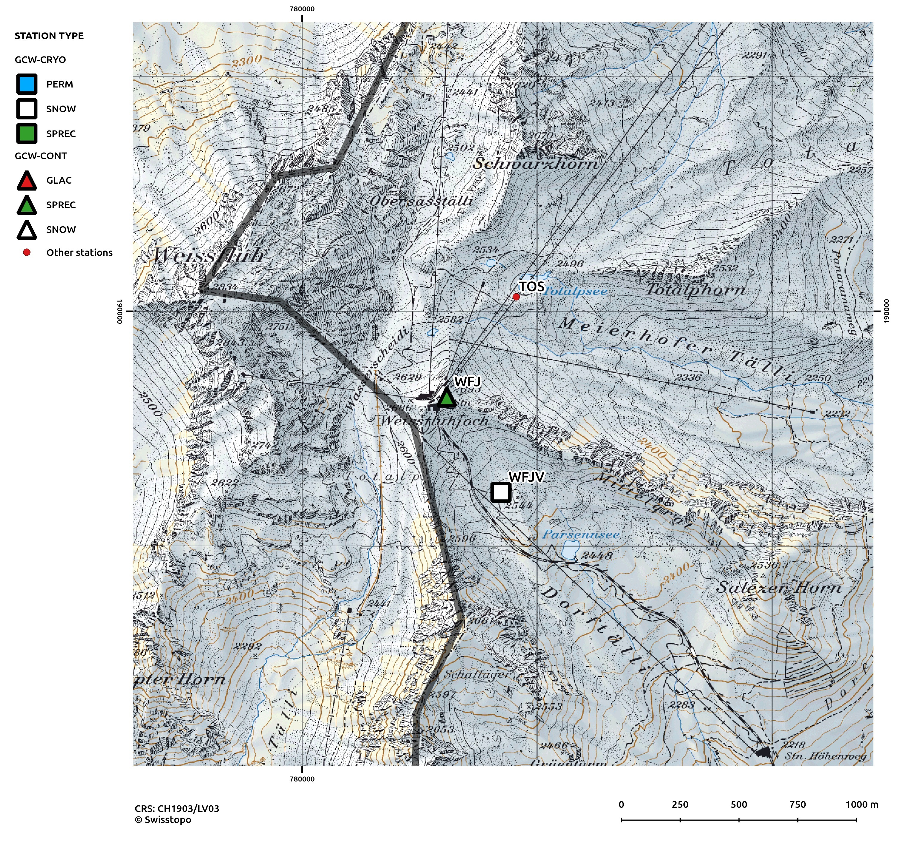
Interactive map available here: http://bit.ly/1qEgXRJ
Other Networks to Which This Contributing Station Belongs
This station is part of the automatic monitoring network of MeteoSwiss (SwissMetNet)
Measurement Methods Used
WMO Technical Regulations
Data Information
Are the data quality controlled? No
How are the data accessible? HTTP (web), an existing data center
Data availability (may depend on the variable measured): in real-time
Measurements
The measurements made at Weissfluhjoch SwissMetNet AWS (WFJ) are listed in the following tables. (Note: If End Year is blank, measurements are ongoing.)
Cryosphere Measurements
Element
Variable
Start Year
End Year
Frequency
Snow
Depth
1980
Continuous
Snow
Snowfall depth
1980
Continuous
Atmosphere Measurements
Element
Variable
Start Year
End Year
Frequency
Met
Air temperature
1980
Continuous
Met
Humidity/vapour pressure
1980
Continuous
Met
Wind speed and direction
1980
Continuous
Met
Air pressure
1980
Continuous
Met
Total precipitation
1982
Continuous
Radiation
Downwelling shortwave
1980
Continuous
Radiation
Downwelling longwave
2007
Continuous
Radiation
Sunshine duration
1980
Continuous
Measurement Notes and Other Measurements
Category
Description or List
Snow
Snow depth and depth of snowfall are both measured and provided by the WSL Institute for Snow and Avalanche Research SLF Davos (see station Weissfluhjoch Versuchsfeld (WFJV))
Atmosphere
Precipitation is measured on Weissfluhjoch Versuchsfeld (2536 m asl), height adjustable gauge kept 1.5 to 2 m above snow / ground. Daily measurements available for the period 1974-1982. Most of the precipitation falls as solid precipitation.
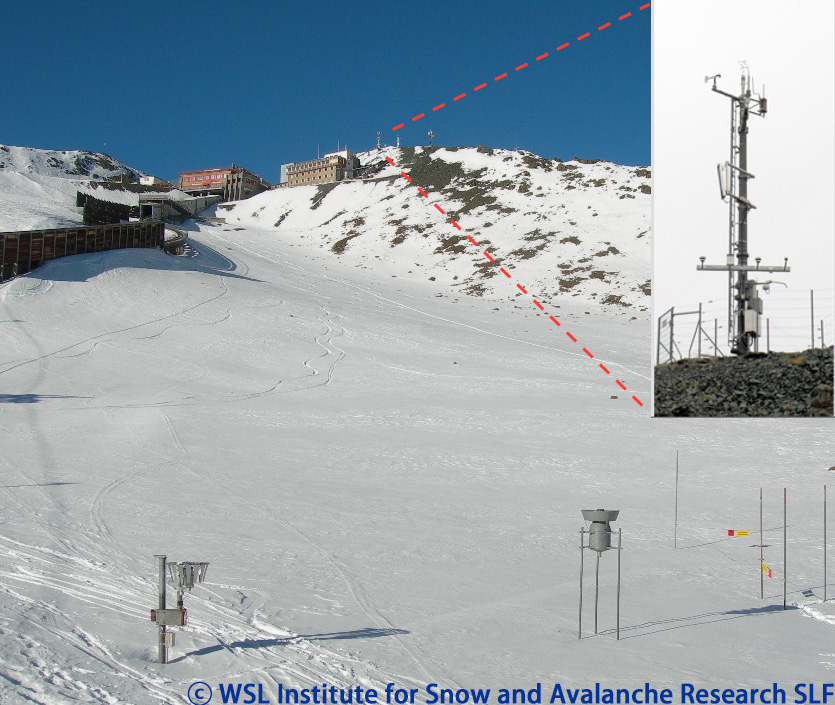
A Pitot-tube anemometer as well as instruments measuring incoming short and downwelling long-wave radiation are also installed on the wind mast (property of WSL Institute for Snow and Avalanche Research SLF)
The fifth weather radar Weissfluhgipfel of the Swiss Weather Radar Network, located on top of Weissfluh, 2840 m above sea level commenced operation in December 2016

The station was originally registered based on WMO Pub 9 Vol A information containing these observation remarks: AUT;M;RAD;SNOW;SOLRA;SUNDUR (see code table A for explanations). These remarks imply the following additional observations that could not be registered automatically: Radiation measurements; Snow survey; Solar radiation measurements.
Interactive map available here: http://bit.ly/1qEgXRJ