 |
Metadata
|
 |
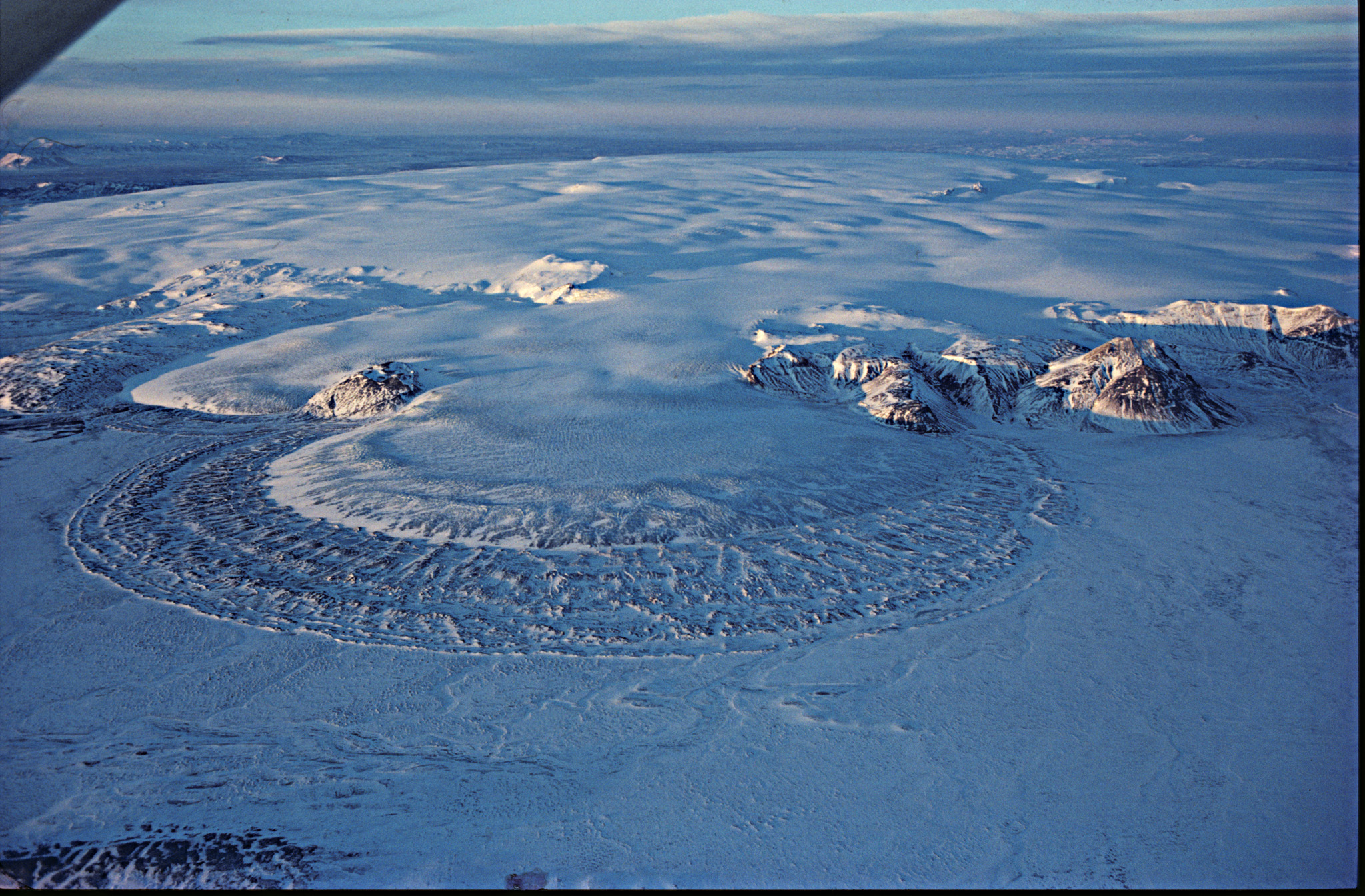
Hofsjökull
Integrated CryoNet Cluster Information
Stations in This Site
This site is comprised of the following stations:
- Hofsjökull Ice Cap - CryoNet Station
- Hveravellir - CryoNet Station
Broad Research Focus
The Hofsjökull site is a key area within the North Atlantic region for investigating the effects of climate variations on glacier mass balance. Glacier changes in Iceland are relatively well known within the timespan of instrumental meteorological observations and mass balance measurements have been conducted at the site since 1988. The data provide constraints for modelling the changes of one of Iceland´s large highland ice caps to projected atmospheric warming in the period 2000–2200. Such modeling is important for hydropower utilisation and general assessment of changes in the natural environment of Iceland resulting from global warming.
Integrated Approach
Monitoring and research within the Hofsjökull site encompasses:
• Annual measurements of glacier mass balance.
• Production of digital elevation models of the ice-cap surface every few years (from lidar measurements and aerial and satellite photogrammetry).
• Regular visits to the ice cap margin at selected locations and monitoring of ongoing changes.
• Measurements of discharge and liquid conductivity in rivers flowing from the ice cap Meteorological observations at one CryoNet station near the ice cap and at four additional AWS´s.
• Snow cover observations on a regular basis at three specific locations.
• Intermittent studies of permafrost changes at elevations above 600 m.
Together, these observations allow an integrated assessment of cryospheric changes in Central Iceland on decadal timescales.
Representativeness of the Cluster
The area encompassing the Hofsjökull site is highly representative for the highlands of Central Iceland, which cover about 40% of the area of the country (a total of approximately 40,000 km2). Air masses traveling in from practically all directions deliver liquid and solid precipitation to the site and some of Iceland´s largest glacial rivers originate there. Hofsjökull is dome-shaped ice cap within the elevation range 650–1800 m, which displays dynamic behaviour characteristic for temperate glaciers. It also harbors a volcanic massif and other site-specific phenomena that are typical for ice caps in Iceland.
Cluster Facilities
• Four huts are available within the Hofsjökull site for teams visiting the site on a regular basis.
• Five automatic weather stations, including the long-term climate observatory at Hveravellir CryoNet station.
• Three hydrometric stations on glacial rivers flowing from Hofsjökull, delivering real-time data on discharge, water temperature and conductivity.
• Seven stations for high-precision GPS-monitoring of crustal movements in response to glacier mass changes.
Other Networks to Which This CryoNet Cluster Belongs
- WMO
- WGMS
- GLIMS
- CHIL
- ISGPS
- Icelandic Glaciological Society: Monitoring of Glacier Variations
Measurement Methods Used
- WMO Technical Regulations
- GTN-G/WGMS
Data Information
- Are the data quality controlled? yes
- How are the data accessible? FTP, an existing data center
- Data availability (may depend on the variable measured): in real-time, in near real-time, delayed less than one month, delayed less than one year, delayed more than one year
Publications
Einarsson, B. & Jónsson, S. (2010). The effect of climate change on runoff from two watersheds in Iceland. Icelandic Meteorological Office, Report, VÍ 2010-016. 34 pp.
Jóhannesson, T., G. Aðalgeirsdóttir, H. Björnsson, P. Crochet, E.B. Elíasson, S. Guðmundsson, J.F. Jónsdóttir, H. Ólafsson, F. Pálsson, Ó. Rögnvaldsson, O. Sigurðsson, Á. Snorrason, Ó. G. B. Sveinsson & Th. Thorsteinsson (2007). Effect of climate change on hydrology and hydro-resources in Iceland. Final Report of the project Veður og orka (Climate and Energy), OS-2007/011. 91 pp.
Jóhannesson T, Björnsson H, Magnússon E, Guðmundsson S, Pálsson F, Sigurðsson O, Thorsteinsson Th, Berthier E: Ice-volume changes, bias estimation of mass-balance measurements and changes in subglacial lakes derived by lidar-mapping of the surface of Icelandic glaciers. Annals of Glaciology 2013, 54 (63), 63-74. doi: 10.3189/2013AoG63A422
Thóra Ellen Thórhallsdóttir (1996). Seasonal and annual dynamics of frozen ground in the central highland of Iceland. Arctic and Alpine Research, 28 (2), 237-243.
Sigurðsson, F.H., T.K. Antonsson & Þ. Pálsdóttir (2003). Veðurstöð og veðurfar á Hveravöllum á Kili (Climate at the Hveravellir weather station, Central Iceland). Icelandic Meteorological Office. Report No. 20. 122 pp.
Sigurðsson, O., T. Jóhannesson, Th. Thorsteinsson & G. Larsen (2002). Ice core drilling on the Hofsjökull ice cap for measuring glacier mass balance. Nordic Hydrological Programme Report, 47. Proceedings of the XXII Nordic Hydrological Conference, Røros, Norway, August 4-7 2002.
Thorsteinsson Th, Björnsson H (Eds): Climate Change and Energy Systems. Impacts, Risks and Adaptation in the Nordic and Baltic Countries. Nordic Council of Ministers, TemaNord 2011:502, 228 pp.
Thorsteinsson, Th., T. Jóhannesson, O. Sigurðsson, E.Ö. Hreinsson, S.M. Ágústsson & E. Tómasson (2003). Afkomumælingar á hábungu Hofsjökuls í maí 2003 (Mass balance measurements at the summit of Hofsjökull, May 2003). National Energy Authority, Report OS/2003-53. 51 pp.
Measurements
The measurements made at Hofsjökull are listed in the following tables. This is a combination of measurements made at the stations within the site, where the start and end years in the tables are the earliest and latest years of measurement. (Note: If End Year is blank, measurements are ongoing.)
Cryosphere Measurements
| Atmosphere Measurements
|
Measurement Notes and Other Measurements
| Category | Description or List |
|---|---|
| Snow | Snow measurements at the Hveravellir CryoNet Station were started in 1965. Snow measurements at the Hofjökull CryoNet Station were started in 1988, forming part of the mass balance program on the ice cap. |
| Glacier | Variations of the ice cap front have been monitored regularly at the following outlet glaciers from Hofsjökull: Múlajökull: Since 1932 Nauthagajökull: Since 1932 Blágnípujökull: Since 1932 Sátujökull: Since 1950 Kvíslajökull: Since 2002 Sporadic observations exist from other outlets. See information submitted for Hofsjökull CryoNet station. |
| Atmosphere | The Hveravellir meteorological station was manned in 1965-2004 but has been operated as an automatic station since 2004. |
| Hydrology | Hydrometric observations are conducted on glacial rivers flowing from Hofsjökull to S- and N-Iceland. The longest data series, on the river Þjórsá, goes back to 1948. At present 10 hydrometric stations on rivers flowing from Hofsjökull (of which 3 are included on the accompanying map) deliver real-time data on discharge, water temperature and electric conductivity. Samples for measurements of suspended sediment load are regularly collected. These hydrological measurements, showing diurnal and seasonal variations and glacier floods, provide a unique opportunity for glacier hydrology research. |
| Ecology | South of the ice cap lies the Þjórsárver natural reserve, a unique ecosystem protected by the international RAMSAR convention on wetlands and one of the few regions in Iceland where permafrost mounds have been observed and studied in detail. Detailed studies of tundra ecosystems have been carried out in Þjórsárver. In addition, communities of microbial and invertebrate life in glacial rivers of the Hofsjökull region have been investigated. |
| Oceanography | No oceanographic observations are applicable. |
| Other | Several stations for continuous, high-precision GPS-monitoring of crustal movements are operated in Iceland. It is proposed to include seven stations operated within the ranks of the CHIL (Central Highland) network in the Hofsjökull Cryonet site. These stations have been in operation since 2007 and together they yield information on isostatic adjustment in response to mass balance changes of Hofsjökull and other ice caps in the Icelandic highland. The forefield of Múlajökull, a surge-type outlet glacier from Hofsjökull, has attracted the attention of geomorphologists in recent years, as the only known presently active drumlin field on Earth. |

The site and the measurement network in the region includes:
• The Hofsjökull ice cap (CryoNet station), with an area of 820 km2 and an estimated volume of ~180 km3. Variations of the glacier front have been monitored since the 1930s on the southernmost outlet of Múlajökull and for a shorter period at other locations. Winter and summer mass balance and ice-flow velocity have been measured at 25 stake locations on Hofsjökull since 1988.
• Five automatic weather stations in the Icelandic highland near the ice cap, including the long-term climate observatory at the CryoNet station Hveravellir, which was the only manned station in the interior of Iceland in the period 1965–2004.
• Three hydrometric stations on glacial rivers flowing from Hofsjökull, delivering real-time data on discharge, water temperature and conductivity. Power stations on rivers receiving part of their meltwater from Hofsjökull produce more than 50% of the currently available hydroelectricity in Iceland, making the ice cap an important water resource.
• Three highland sites near the ice cap where snow depth and snow cover have been monitored on a regular basis.
• Seven stations for high-precision GPS-monitoring of crustal movements in response to glacier mass changes.
There is a unique area of permafrost mounds in the Þjórsárver natural reserve south of the ice cap and the forefield of the Múlajökull outlet glacier contains the only known active drumlin field on Earth.
In recent years, satellite and airborne measurements have been carried out over Hofsjökull, including repeat lidar measurements that provide an opportunity for accurate geodetic mass balance estimates for the individual ice flow basins of the ice cap. Hofsjökull and other main ice caps in Iceland are sensitive indicators of climate variations in the North Atlantic region and several models have been employed to simulate the mass balance and dynamics of the ice cap under past, present and projected future climates, as part of international efforts to assess the contribution of glacial melt to ongoing sea-level rise.